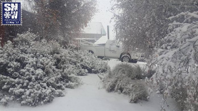
SA Braces for “Significant Snow”and Possible Flooding
The South African Weather Service (SAWS) has warned that an intense cold front is expected in SA from 15-17 July, making landfall over the Western Cape on Saturday night into the early hours of Sunday morning, 16 July 2017. The good news is this could bring good rain for the dams… SAWS said: “Ahead of […]
The South African Weather Service (SAWS) has warned that an intense cold front is expected in SA from 15-17 July, making landfall over the Western Cape on Saturday night into the early hours of Sunday morning, 16 July 2017. The good news is this could bring good rain for the dams…
SAWS said: “Ahead of the front, rain and showers are possible over the south-western parts of the Western Cape from Saturday afternoon, 15 July 2017, spreading to the remainder of the Western Cape and the western and southern parts of the Northern Cape on Sunday.
“Rain and showers will be expected over the Eastern Cape by Sunday afternoon. Significant rainfall is expected over the south-western parts of the Western Cape during Sunday morning which may result in localized flooding in places in the Cape Metropole, Overberg and Cape Wineland Districts.
“Freezing levels are expected to drop due to the passing cold front, allowing for snowfalls over the mountainous areas of the Western Cape and Eastern Cape on Sunday, to as low as 1200 to 1400m above sea level.
“Very cold maximum temperatures (<10°C in places) can be expected across the Western Cape and Northern Cape on this day, with a general decrease in temperatures expected across the rest of the country.
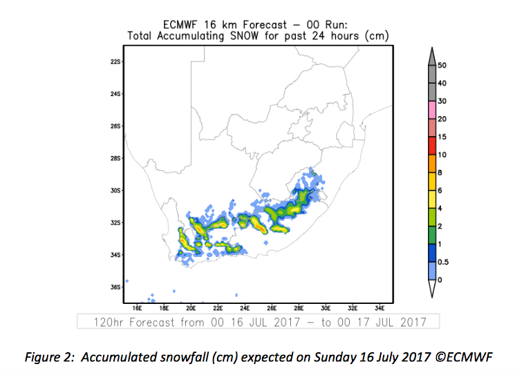
With significant snowfall amounts expected (see Figure 2), mountain passes may be closed over the Western Cape and Eastern Cape, leading to traffic disruptions. The public should take care in this regard.
SAWS said stronger interior winds can be expected over most parts of the country on Sunday and a possible gale force south-westerly wind (approximately 70 km/h) can be expected between Cape St. Francis and East London.
Heavy swell in excess of 4 metres can be expected between Cape Columbine and Port Elizabeth from Saturday evening, spreading to East London by Sunday morning and reaching Kosi Bay by Monday afternoon.
High seas with wave heights from 6 to 9 metres can be expected between Cape Point and East London from Monday morning. We urge all beach-goers and sailors to please take note of these conditions.
By Monday, 17 July 2017, the cold front will move to the east of the country, with conditions improving significantly across the southern and western parts. Isolated morning showers will be possible along the coastal areas of KwaZulu-Natal on this day, while very cold mornings with frosty conditions are expected across most of the interior, according to WeatherSA.
Cautioning the Public Against Hoaxes on WhatsApp
SAWS said it is aware of a hoax message doing the rounds that this system will be “twice as strong as the system of June 2017.” This is false and the public is urged to always consult the official sites of the South African Weather Service as the authoritative voice on weather and climate warnings.
Alert for Gauteng: Worst Cold Front Yet
Gauteng Weather has issued an ALERT suggesting the “WORST COLD FRONT yet this winter could hit GP late Sunday, bringing below freezing temps to most parts.”
In another tweet GW said the strong cold front is likely to hit Gauteng late Sunday into Monday. “Joburg set for FIRST BELOW FREEZING overnight temps of winter 2017!”
They also pointed out that Saturday marks the middle of the meteorological winter!
UPDATE Saturday evening:
Cold front now rushing towards the west coast. All on track. Enjoy the rainfall tonight if you are in the Western Cape. pic.twitter.com/JAfURpSgT1
— SA Weather Service (@SAWeatherServic) July 15, 2017
Earlier Saturday
Cold front positioned south-west of Cape Town. AVE Rainrate predicted for SW Cape around 3.5 to 4.5mm per hour between 8pm tonight- 2am Sun. pic.twitter.com/ek7q2V0bFi
— SA Weather Service (@SAWeatherServic) July 15, 2017
Updated information may also be accessed on www.weathersa.co.za as well as via the South African Weather Service’s Twitter account @SAWeatherServic
Source: WeatherSA