South Africa’s Early Mountain Passes – a Feat of Epic Engineering
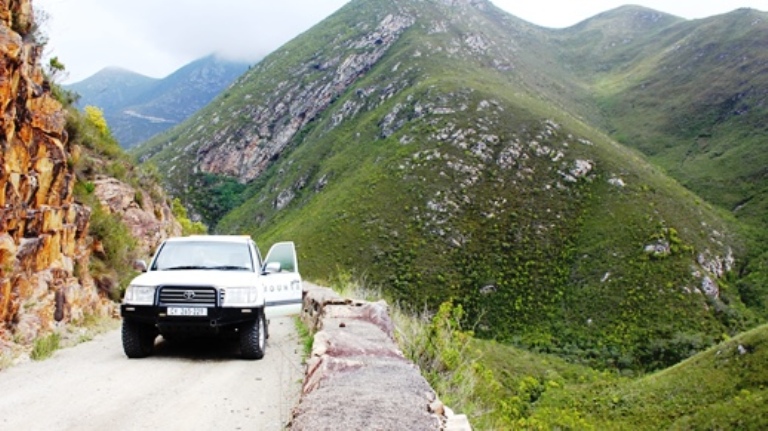
A mountain drive through a scenic pass in South Africa is magical, and exploring South Africa’s passes is now on the list of ‘must do’ attractions for both locals and tourists… writes Beverley Ballard-Tremeer. The passes may not be the longest or the highest in the world, but never-the-less many are spectacular. Two are listed in […]
A mountain drive through a scenic pass in South Africa is magical, and exploring South Africa’s passes is now on the list of ‘must do’ attractions for both locals and tourists… writes Beverley Ballard-Tremeer.

The passes may not be the longest or the highest in the world, but never-the-less many are spectacular. Two are listed in the top twenty mountain passes worldwide: Chapman’s Peak Drive and the Sani Pass. To experience a drive through these two amazing passes visit each one on video at www.mountainpassessouthafrica.co.za

Nowadays one takes for granted access over mountain ranges from one place to another. How did people do it in the past? The answer is on foot, often following a pass route established by grazing antelope moving seasonally from one pasture to another. The cattle-owning Khoi in the Cape – previously called Hottentots – used these routes for the same purpose: better grazing for their herds.
It is these pathways over mountain ranges that set down the routes for South Africa’s first passes many centuries later.

With the new trend of driving South Africa’s passes, interest in their history is growing. The earliest surveyed and engineered passes are all in the Western Cape. In the 19th century this area was under British rule and was known as the Cape Colony.
Some of these pioneer passes have been declared as National Monuments or National Heritage Roads, and we salute the men who designed them as well as the convict labourers who built them.
The first mountain pass
The arrival of the Dutch Jan van Riebeck at the Cape of Good Hope (now Cape Town) in 1652 marked the beginning of permanent European settlement in the region. And these settlers brought horses with them as well as oxen and wagons.
For the first time in southern Africa it was possible to transport goods from one place to another in a wagon pulled by oxen. In difficult terrain a man on horseback could follow the existing footpaths. However there were no mountain roads for wagons, and the mountains ranges of the Cape were formidable.
The oldest mountain pass in South Africa is Constantia Nek. Jan van Riebeck ordered a rudimentary road to be built over a saddle – or nek – in the Table Mountain range and named it Clooff Pass in 1657. It was mainly used to transport timber by ox wagon from the Hout Bay valley to the settlement at the Castle in present day Cape Town.
At various times it was improved and widened. In the early 1900s the pass was tarred. The summit is 212m above sea level. Today it is the highest point on the Two Oceans Ultra Marathon route.

Under Dutch rule, the inhabitants of each farming District were responsible for the building and maintenance of roads in that District. Money was always in short supply and the roads were bad.
There were many natural harbours along the coast of the Cape, so goods could be transported by sea to new villages along the coast line. As settlements became established in the interior of the Cape Colony, transport of goods was essential.
A series of mountain ranges blocked off easy access from Cape Town to the towns in the eastern part of the Cape Colony. Another series blocked access from the coastal ports and towns to settlements in the interior of the country. Taking a wagon over these mountain ranges was near impossible. Never-the-less, in order to trade, some rough and dangerous routes were fashioned.

Franschhoek Pass
When the Cape became a British Colony in 1806, the British Governor of the Cape and his successors realised the need for good roads and passes to facilitate trade between the various Districts in the Cape Colony. At long last the necessary funds for their construction were made available.

The first properly engineered pass in southern Africa was the Franschhoek Pass between Franschhoek and Villiersdorp. It was completed in 1825 and was the only safe route that travellers and traders heading for the eastern Cape Colony could use.
It was built by the soldiers of the Royal Africa Corps. Along the route, a plaque at the little stone bridge called Jan Joubert’s Gat commemorates their extremely hard labour.

The pass followed an existing track that the local Khoi referred to as ‘Elephants Pass’. Centuries ago it may well have been a route initially treaded down by elephants crossing the mountains every change of season. It was then used as a foot path and later a bridle path.

Sir Lowry’s Pass
The next properly surveyed and constructed pass was Sir Lowry’s Pass over the Hottentots-Holland Mountains between Somerset West and Grabouw. It was opened in 1830. The engineer was Charles Michell, who had gained experience on the Franschhoek Pass.

The pass was named after Sir Lowry Cole, the then Governor of the Cape Colony. It provided another safe route for traders and farmers to access the eastern Cape.
The road was narrow and vehicles could only pass each other at selected places. Wagons had to pay a toll at the summit (920m) to repay its huge construction costs. In fact this pass was used so frequently that the costs were paid off quite early.

Sir Lowry’s Pass was planned and built so well that it remained in use for 100 years! Only in 1930 was the pass widened and tarred. It was then used for a further 28 years before being reconstructed in 1958. The number of vehicles using this N2 national road connecting Cape Town to the Garden Route Cape increased annually so in 1984 the upper parts were widened to four lanes in a reinforced concrete cantilevered construction.

These first two passes provided two access routes from the Cape Town area to the eastern Cape. Trade between the western and eastern areas of the Cape Colony was now possible.
The treacherous Hottentots-Hollands Pass
Prior to the opening of the engineered Sir Lowry’s Pass in 1830 there had been a rough pass called the Hottentots-Holland Kloof Pass that had been in use for about 150 years. It followed a route used by Khoi for centuries. They called it Eland’s Pass. So probably eland had once crossed it seasonally, in search of greener pastures, and trampled a route.
By 1820 about 4 500 transport wagons per year used this route to trade with the farmers in the fertile valleys to the east.

The pass was so treacherous that 1 in every 5 wagons was damaged. Farmers, ever fearful of losing their wagons and cargo down the steep precipices, tended to lock their wagon wheels for the descent. This literally turned the wagons into sleds, causing massive damage to the road surface.
The striations left by the wagons on the rocks can still be seen, and were declared a National Monument in 1958.

The notorious Cradock Pass
The need for excellent engineers to survey and construct passes through steep mountain ranges is best illustrated by the disastrous Cradock Pass through the Outeniqua mountains.

In 1811 the Landrost of the town of George – a coastal timber supply settlement – requested that a pass be built from George over the Outeniqua mountains. He realised that access to the interior was vital for the prosperity of George. He suggested upgrading the bridle path immediately behind the town. The then Governor of the Cape, Sir John Cradock, agreed, as the proposed pass would benefit the whole of Cape Colony.
Forty labourers took two months to complete the 10km Cradock Pass. It went almost directly over the mountain with no sharp bends or contour paths.
From the very start there were complaints about this exceedingly steep and formidable road. The gradient was so severe that two teams of oxen were needed to pull a loaded wagon up the pass. In places wagons had to be taken apart and carried. Disasters were frequent and travellers were held up for days while repairs were effected.

Farmers in the area around the top of the pass hesitated to risk a precious ox-wagon on this route. Many decided to ignore the potential market in the direction of Cape Town and rather undertook a longer trek into the interior to sell their produce at small settlements.
Today the Cradock Pass is used only by hikers keen to have a day of strenuous exercise. The deep ruts cut by the wheels and brake shoes of the ox-wagons can still be seen.
The Montagu Pass
The 17km long Montagu Pass was built to replace the Cradock Pass. It was named after the Colonial Secretary, the Hon. John Montagu, who gave the go-ahead for building a new pass from George to Oudtshoorn. Work started in 1844 and the pass opened in 1848.

Veteran traveller and author Anthony Trollope enthused that it was “…equal to some of the mountain roads through the Pyrenees”. A wagon needed only a single team of oxen to ascend the pass, and it took far less time compared with the three days it had taken to negotiate the old Cradock Pass.
The Montagu Pass is the only one in the area that was not engineered by Andrew or Thomas Bain. The engineer in charge of the work was Henry Fancourt White, an experienced road engineer from Australia. John Montagu, who had spent decades in Australia, brought him in to construct the pass.

This was the first pass ever to be built using convict labour exclusively. Between White and Montagu (both staunch Anglicans) the decision was made to put prisoners to work. In their view this policy allowed convicts to serve their time productively to society and simultaneously saved the financially insecure Cape Colony the commercial costs of labour.
The convicts working on the Montagu Pass and later passes were accommodated in villages and meals were provided. Today we would regard using convicts as labourers on such tough projects as abhorrent However at that time, penal labour was not unusual in Britain, the USA and elsewhere.
Building a pass with no construction vehicles to help excavate or move boulders or smooth a road was a mammoth task. Dynamite was only invented in 1867. So gunpowder was used to blast out about 9 kilometres of solid bedrock to provide gradients suitable for ox wagons.

The 17km long Montagu Pass lays claim to being the oldest, unaltered pass still in use in South Africa. It is open to traffic and has remained a gravel road. This historic pass, as well as the Old Tollhouse, where once the toll of one penny per wheel and one penny per ox had to be paid, were declared National Monuments in 1972.

The legacy of the two Bains
The true advancement of the road transport system in the Cape Colony only really began with the arrival of John Montagu as Colonial Secretary of the Cape Colony in 1843.
During his nine years in the Cape Colony he worked tirelessly and successfully in many arenas. One was the building of roads and passes to link various towns. It is thought that his death in 1853 was hastened by sheer exhaustion.


John Montagu and Charles Michell (Surveyor-General, Civil Engineer and Superintendent of Works) introduced an ambitious road and pass building program in order to make trading easier.
Their goal was achieved by the father-and-son combination of Andrew and Thomas Bain, whose civil engineering prowess was unsurpassed. They expanded the existing network of old Dutch roads and constructed a multitude of passes in the Cape Colony.

In 1843, at the age of 48, the self-taught Andrew Geddes Bain was appointed Engineering Inspector the Cape Roads Board. He was involved with the surveying, planning and construction of fourteen network roads and seven major mountain passes between 1832 and 1858.
As well as being a brilliant road engineer, Andrew Bain was probably South Africa’s first palaeontologist and a pioneer geologist.
His most famous pass is the 17km long Bain’s Kloof Pass, built in about 1849 using convict labour. It provided a more direct route from the town of Wellington to the more northern towns of Ceres and Worcester.
It is the only pass called after the engineer who built it; perhaps all notable names of the time had already been used! Having stood the test of time the Bain’s Kloof Pass is now a National Monument.

Thomas Charles John Bain served his apprenticeship from 1848 to 1854 as his father’s assistant. After passing first in the Government Examinations in 1854, he was promoted to Roads Inspector. At that time there were only four engineered major passes in the Cape Colony, one of which Andrew Bain had built.
Thomas and his father’s careers as road builders continued to be intertwined until Andrew’s death in 1864. Andrew Bain engineered seven major passes and Thomas twenty-six, many of which are still in use today. Thomas also expanded the existing road network by 900 kilometres. These well-built roads contributed greatly to the Cape Colony’s development.
Thomas Bain was an exceptional road and pass engineer. He became known as ‘the man with theodolite eye’ due to his uncanny ability to visualise the line a pass should take with his naked eye.
He was also known as an excellent ‘people’s person’ and was uncommonly kind and thoughtful to the prison gangs who worked on his passes.

Travelling on horseback with a theodolite and compass Bain would explore the area where the Cape Governor wanted a pass. His sketches assisted him in planning a pass.
He would work on two or three projects at a time, checking construction progress, again on horseback. He always lived on site and his wife and 13 children accompanied him!
His many passes through the mountain ranges between the narrow coastal plain east of Cape Town and the interior of the Cape Colony played a major role in opening up the vast hinterland of South Africa for trade.
Thomas Bain belongs on the list of South Africa’s greatest 19th century heroes; it is no wonder that his biography is entitled ‘A Colossus of Roads’.
Prince Alfred’s Pass – in use for 150 years

Prior to the construction of the Prince Alfred Pass a jerry-built wagon route over the Paardekop Mountains was used, but it was treacherous in the extreme.
In 1857 Andrew and Thomas Bain went to survey a route for a new pass. The route chosen may have partially followed the elephant trails formed by parades of these majestic creatures migrating to the Langkloof when the Knysna forests became too wet and cold in the winter.
There were a multitude of technical problems so the cost in their proposal was huge. Never-the-less the go ahead was given.

Thomas moved his large family to the farm De Vlugt. He and his convict labourers started work on this phenomenally long pass in 1863. The distance from one end to the other is 67km: to this day it remains South Africa’s longest pass..
Accommodation for the labourers was built, in village style. Meat, dried beans, soup and other kinds of food were cooked in large pots for the convicts. An ox and sixteen sheep were slaughtered daily to provide meat for everybody on the project!

Construction began in 1863. Light traffic started using the completed section in 1867. The official opening was on 29 September 1868. Initially known as the Knysna Road it was finally named Prince Alfred’s Pass in honour of Queen Victoria’s 2nd son, who came elephant hunting in the forests of Knysna in September 1868.
It is mind boggling to think that without bulldozers, pneumatic drills, graders, trucks and dynamite, Thomas Bain completed this 67km long pass in under five years.
The magnificent gravel route features everything a visitor could wish for: bridges, cliffs, cuttings, dry stone supports, hairpins, views, forests and waterfalls. No images can do justice to this pass. To experience a drive through the pass on video visit Prince Alfred’s Pass on www.mountainpassessouthafrica.co.za

The Swartberg Pass
Thomas Bain’s last pass was the 27km long Swartberg Pass that connects Oudtshoorn in the Little Karoo with Prince Albert in the Great Karoo. Now a National Monument, it is one of the most spectacular mountain passes in South Africa.

The first tender for the pass was awarded to one John Tassie. But the mountains beat him after 6km of construction and he went bankrupt. The by-now highly experienced Thomas Bain took over.
The route reaches a height of 1 585m above sea level. Never-the-less the ‘man with theodolite eye’ kept the gradient throughout this 24km long pass lower than 1:8 compared to the steeper 1:6 of the Montagu Pass.
Working with 250 convicts, Thomas finished the technically challenging Swartberg Pass ahead of time and under-budget. Construction started in 1884 and the pass was officially opened on 10 January 1888.
The opening was a big event for the inhabitants of Prince Albert. All the shops and offices were closed for the day to allow everyone to participate in the festivities. At 7am a procession of about 100 vehicles – spiders, cape carts and mule wagons – set off on three hour trek to the open terrain near the summit. It was estimated that there were about 500 people present, including reporters from six newspapers.

Today one can scarcely believe that this magnificent pass through the Swartberg mountains was built manually. Only pickaxes, spades, sledgehammers, crowbars, wheelbarrows and gunpowder were available.
On the 100th anniversary of the opening of the pass in 1988, the immense work of the convict labourers was acknowledged in a commemorative plaque.
Over the course of his road building career Bain had perfected several special techniques. When possible he reduced the use of expensive gunpowder with a low-cost option. Fires were built over large boulders, then cold water was thrown on them to split them. Sledgehammers were then used to break the rock into smaller pieces that were easier to move.
He was highly skilled in the construction of dry-walling to support a pass. He used the principles of cohesion and friction.

In one place on the Swartberg Pass the dry stone packed wall supporting the road is 2,4km long! The dry stone walls on this pass range in height from 1,5 m to 13m. At the base the walls are at least 1m wide, decreasing to 30cm at the top. They slope inward to better support the road. These stone walls have held the road in place for 120 years!

Today the still-gravelled and unaltered Swartberg Pass is a National Monument and bears testament to the genius of South Africa’s premier pass engineer, Thomas Charles John Bain.

Written by Beverley Ballard-Tremeer in tribute to all of South Africa’s pass engineers and their labourers.
MORE
The expert on South Africa’s 684 passes is Trygve Roberts. He runs the website www.mountainpassessouthafrica.co.za. It is dedicated to the documentation, photography and filming of these special routes. Many of the images above are courtesy of Trygve Roberts.
Biography of Thomas Bain: ‘A Colossus of Roads’ by Patricia Storrar. Published by Murray & Roberts/Concor, 1984.