
Strong cold front to bring temperature drop to SA
South Africans will experience chilly conditions in the coming days as a strong cold front is expected to make landfall in the Western Cape on Friday evening, 7 July. The effects of the weather system will eventually be felt in the eastern parts of the country, according to the South African Weather Service (SAWS). COLD FRONT TO […]

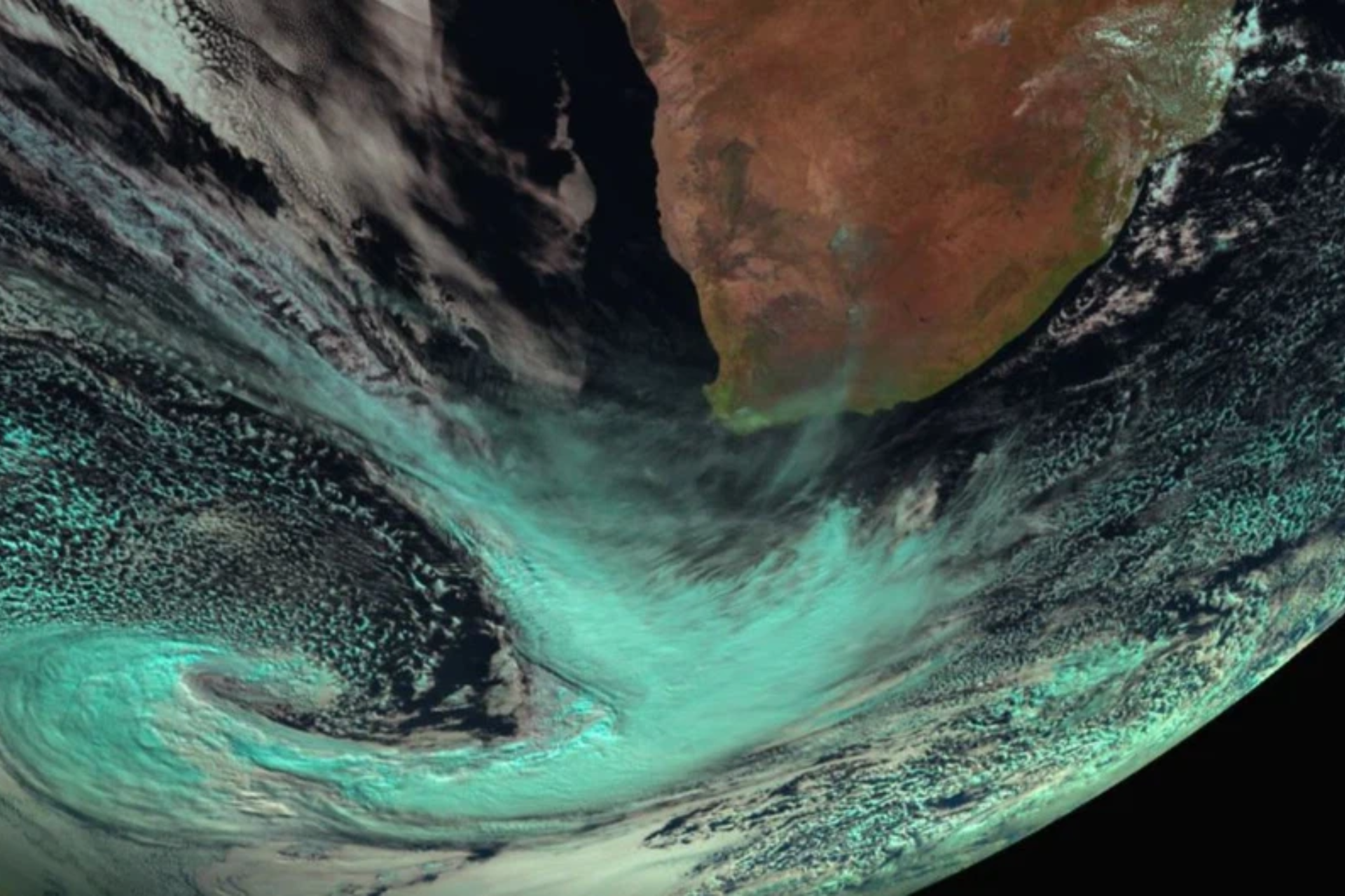
South Africans will experience chilly conditions in the coming days as a strong cold front is expected to make landfall in the Western Cape on Friday evening, 7 July. The effects of the weather system will eventually be felt in the eastern parts of the country, according to the South African Weather Service (SAWS).
COLD FRONT TO BRING SIGNIFICANT TEMPERATURE DROP
The cold front is currently situated off the coast of the country, to the southwest. It will make landfall on Friday evening and bring showers and rain to the southwestern parts of the Western Cape from Friday afternoon, spreading to the Northern Cape and Eastern Cape on Saturday and KwaZulu-Natal (KZN) and Mpumalanga by Sunday, 9 July.
“A significant drop in temperature is expected over the extreme western parts of the country on Friday, spreading eastwards on Saturday.
“These cold to very cold temperatures will reach the eastern parts of the country by Sunday,” said the weather service.
READ: ‘Very cold, wet and windy’: Another cold front to hit the Cape
POSSIBILITY OF SNOWFALL, STRONG WINDS
There is a possibility of snowfall in high-lying areas in the southern Namakwa in the Northern Cape and the interior of the Western Cape on Friday.
The snowy conditions are expected to reach the Eastern Cape and southern Drakensberg by Monday. Disruptive snowfall is also a possibility in places.
Strong winds are associated with the cold front. Wind speeds are expected to reach gale force along the coast.
THE WEATHER SERVICE HAS ISSUED NUMEROUS WEATHER WARNINGS, INCLUDING:
- Yellow Level 2: Wind over the interior:
Strong to near gale force northwesterly winds (50 to 70 km/h gusting 80 km/h).
Expected over the interior of the Western Cape (eastern parts of the Cape Winelands and Central Karoo) and Southern Namakwa.
- Yellow Level 2: Damaging waves:
Wave heights are expected to increase to 5-7 m from Friday evening.
Initially between Saldanha Bay and Cape Agulhas, then spreading along the west and south coast on Saturday, reaching Port Edward on Sunday.
- Orange Level 5: Damaging winds:
Winds that could result in damage to settlements, properties, and temporary infrastructure.
Expected over Sarah Baartman District Municipality and the western parts of the Chris Hani District Municipality on Friday and Saturday.
- Yellow Level 4: Damaging winds:
Winds that could result in damage to settlements, properties, and temporary infrastructure.
Expected over Joe Gqabi DM, the eastern parts of Chris Hani DM, Amahlathi LM, and Raymond Mhlaba Local Municipalities on Friday and Saturday.
- Orange Level 6: Disruptive snow:
Snow that could result in major mountain passes closed, isolate communities, and loss of livestock.
Expected over Chris Hani, Joe Gqabi District Municipalities, Matatiele, Umzimvubu, Raymond Mhlaba, and Dr. Beyers Naude (Graaf Reinet) Local Municipalities on Sunday and Monday.
ALSO READ: Ramaphosa urges investigators into what caused fatal gas leak