WEATHER: Intense storms and tropical rain expected across SA
Curious about what the skies hold? Discover the latest outlook for all nine provinces across South Africa this Friday, 6 March 2026.

Get daily updates on temperatures, winds and UVB levels, and see what the SA Weather Service predicts for the country.
Here’s the weather outlook for South Africa’s nine provinces.
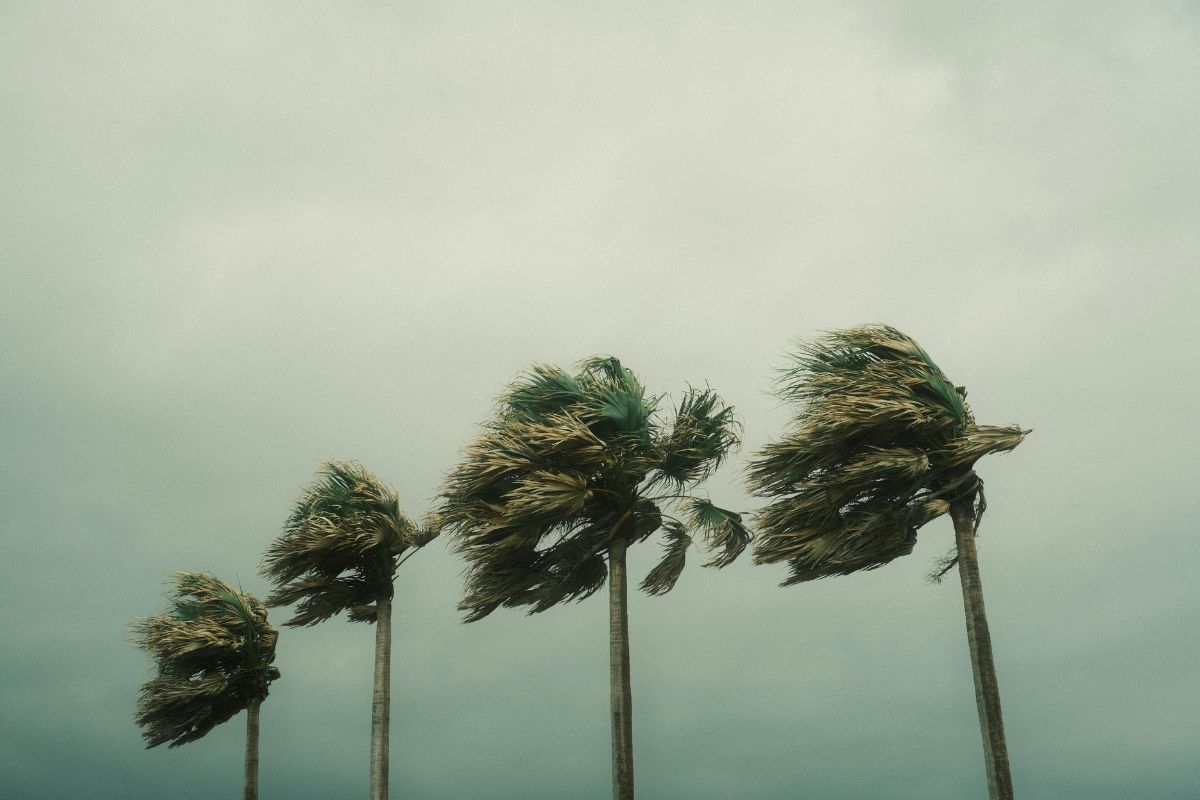
The South African Weather Service has issued multiple severe weather alerts, including an Orange Level 5 warning for severe thunderstorms, as dangerous winds, waves and intense storms threaten several parts of the country.
SEVERE WEATHER ALERTS
IMPACT-BASED WARNINGS
A. Orange Level 5 Warning: Severe Thunderstorms with heavy downpours leading to flooding of roads, settlements and low-lying areas, as well as damaging winds, large amounts of small hail and excessive lighting, are expected over the north-eastern parts of Northern Cape, western parts of North West, as well as the central and eastern parts of Free State.
B. Yellow Level 4 Warning: Severe Thunderstorms with heavy downpours leading to localised flooding of susceptible roads, settlements, low-lying bridges/areas, as well as possible strong damaging winds, hail, and excessive lightning, are expected over the central north-east of the Northern Cape, south-western parts of Free Stare, eastern parts of North West, Gauteng, western Highveld of Mpumalanga, as well as parts of KwaZulu-Natal (except for the extreme north-east).
C. Yellow Level 2 Warning: Severe Thunderstorms with heavy downpours leading to localised flooding of susceptible roads, settlements, low-lying bridges/areas, hail, and excessive lightning, are expected over the south-western parts of Limpopo, as well as the eastern Highveld and escarpment areas of Mpumalanga.
D. Yellow Level 2 Warning: Damaging winds and waves leading to small vessels taking on water and capsizing in a locality and difficulty in navigation at sea, are expected between Cape Point and Plettenberg Bay from the evening, into Saturday.
FIRE DANGER WARNINGS
NIL
ADVISORIES
Hot to very hot and humid weather will result in extremely uncomfortable conditions over the eastern parts of KwaZulu-Natal.
Weather conditions and UVB forecast in South Africa’s provinces
Gauteng
Gauteng can expect cloudy and cool with widespread showers and thundershowers.
The expected UVB Sunburn Index is High
Mpumalanga
Mpumalanga, the Place of the Rising Sun, can expect cloudy and cool to warm with scattered to widespread showers and thundershowers but isolated in the Lowveld, where it will be hot.
Limpopo
In Limpopo, cloudy and warm to hot with scattered to widespread showers and thundershowers but isolated in the Lowveld and Limpopo Valley.
North West
North West, known as Bokone Bophirima in Setswana, can expect cloudy and cool, with widespread showers and thundershowers.
Free State
In Free State, cloudy and cool to warm with scattered to widespread showers and thundershowers.
Northern Cape
The day will start with fog along the coast in the morning, where it will be cloudy, otherwise partly cloudy and cool to warm, becoming fine over the central interior by the afternoon. It will be partly cloudy with isolated to scattered showers and thundershowers in the northeast but widespread in the extreme north-east. The wind along the coast will be light to moderate northerly to north-westerly, becoming moderate southerly to south-westerly in the evening.
Western Cape
loudy to partly cloudy and cool to warm but hot over Beaufort West municipality with isolated showers and rain over the south and south-western parts from the afternoon, but fine overt the central parts in the morning. The wind along the coast will be moderate to fresh northerly to north-westerly along the west coast, but light and variable along the south coast until the afternoon. It will become fresh to strong south-westerly to westerly along the south-west and southern coast from the evening spreading to west coast by the end of the period.
The expected UVB sunburn index is Very High
Eastern Cape
The Western half: Partly cloudy and warm with light morning rain in places. The wind along the coast will be light south-westerly, becoming light south-easterly in the afternoon but moderate south-westerly overnight.
The Eastern half: The day will start partly cloudy to cloudy and warm with scattered showers and thundershowers, clearing from the west in the afternoon. The wind along the coast will be light and variable, becoming light southerly from late morning.
KwaZulu-Natal
Morning fog in places, otherwise cloudy and warm to hot with isolated to scattered showers and thundershowers, but widespread in the west and south. The wind along the coast will be light to moderate westerly to south-westerly between Port Edward and Durban, where it will become moderate to fresh south-westerly to southerly in the afternoon, otherwise moderate to fresh northerly to north-easterly, becoming strong in the afternoon. It will then become moderate to fresh southwesterly to southerly between Port Edward and Durban in the afternoon.
The expected UVB Sunburn Index is Low
Forecast data provided by the South African Weather Service.