PHOTOS: Heavy Rains and Hail Like Snow Hit SA. More Expected Tuesday
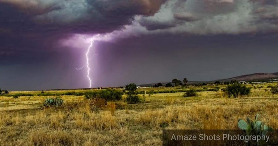
As predicted by the South African Weather Service (SAWS), parts of South Africa experienced severe thunderstorms today, with strong winds and localised flooding still being experienced in Pretoria this evening. Besonderse groot #storm het so 16:15 verby #Fochville beweeg.Iets besonders wat ons nie sommer sien nie. 📸 Quintin Muller @SAWeatherServic @eNCA @venter_annette @debeer_anika @Netwerk24 @maroelamedia […]
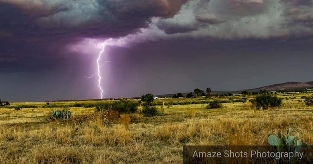
As predicted by the South African Weather Service (SAWS), parts of South Africa experienced severe thunderstorms today, with strong winds and localised flooding still being experienced in Pretoria this evening.
Besonderse groot #storm het so 16:15 verby #Fochville beweeg.
Iets besonders wat ons nie sommer sien nie. 📸 Quintin Muller @SAWeatherServic @eNCA @venter_annette @debeer_anika @Netwerk24 @maroelamedia @huisgenoot pic.twitter.com/jFLth3aoem— ReenvalSA (@ReenvalSA) November 19, 2018
Heavy rain poured down in Gauteng, Mpumalanga (over 40mm in Delmas, just in the first hour) and parts of the Free State and KwaZulu-Natal on Monday… with a major hailstorm – that looked like snow – lashing the area between Standerton and Leandra, just over an hour from Johannesburg.
#Haelstorm by #Charl_Cilliers tussen #Standerton en Leandra 📸 Karen Van der Linde.
@eNCAWeather @SAWeatherServic @AfricaWeather_ @Netwerk24 @venter_annette @debeer_anika pic.twitter.com/gHhsYU1hVF— ReenvalSA (@ReenvalSA) November 19, 2018
SAWS has predicted more heavy rainfall for Mpumalanga and Gauteng tomorrow with just scattered showers over parts of the Free State, Limpopo and North West. South Africans are cautioned to drive carefully.
Heavy #rainfall this afternoon over #Gauteng #SouthAfrica. Video by Andrea Ben. pic.twitter.com/FME1DAEAxU
— South Africa People – SAPeople.com (@sapeople) November 19, 2018
Meanwhile, there are extremely high fire danger conditions expected in the central and eastern parts of the Northern Cape, the western Free State, the western parts of the North West and the Joe Gqabi District Municipality in the Eastern Cape.
Durban and Bloemfontein will reach the highest temperatures (32 degrees Celcius and 31 respectively) with Pretoria and Johannesburg reaching a high of 27 and 26.
WATCH heavy hail falls near Standerton, South Africa
Hael tussen #Standerton en #Leandra 📽: Dries Odendaal @eNCAWeather @SAWeatherServic @maroelamedia @sawx_sa_weather @StormHour @venter_annette @debeer_anika @huisgenoot @JoelGuy_ @_mpnews @Mtpatourism @AfricaWeather_ pic.twitter.com/rVGdDw0Ruj
— ReenvalSA (@ReenvalSA) November 19, 2018
#Haelstorm by #Charl_Cilliers tussen #Standerton en Leandra 📸 Karen Van der Linde.
@eNCAWeather @SAWeatherServic @AfricaWeather_ @Netwerk24 @venter_annette @debeer_anika pic.twitter.com/QG0CRoEIZE— ReenvalSA (@ReenvalSA) November 19, 2018
Hael tussen #Standerton en #Leandra 📽: Dries Odendaal @eNCAWeather @SAWeatherServic @maroelamedia @sawx_sa_weather @StormHour @venter_annette @debeer_anika @huisgenoot @JoelGuy_ @_mpnews @Mtpatourism @AfricaWeather_ pic.twitter.com/etoMg22gx5
— ReenvalSA (@ReenvalSA) November 19, 2018
Hael tussen #Standerton en #Leandra 📽: Dries Odendaal @eNCAWeather @SAWeatherServic @maroelamedia @sawx_sa_weather @StormHour @venter_annette @debeer_anika @huisgenoot @JoelGuy_ @_mpnews @Mtpatourism @AfricaWeather_ pic.twitter.com/GHfmP0msl8
— ReenvalSA (@ReenvalSA) November 19, 2018
Meanwhile today in Deneysville, Free State… a sand storm:
@SAWeatherServic sand storm in Deneysville pic.twitter.com/9nKnnXACWH
— Umar Nana (@Umarnana) November 19, 2018